Pages

Showing posts with label Fisher Street. Show all posts

24/05/2016

Consultation on Stannergate to Broughty Ferry Harbour Coastal Protection Measures Wed 1st June 10:00 - 20:00

Click on map to enlarge
A drop-in consultation about the proposed coastal protection measures between the Stannergate and Broughty Ferry harbour has been scheduled between 10am and 8pm on Wednesday 1st June 2016 at Broughty Castle Bowling Club, 439 King Street, Broughty Ferry DD5 2HA 

You and your friends and neighbours may want to take advantage of the opportunity to see the proposals at the drop-in exhibition and make up your minds how you wish to respond to the Council's enhanced sea defences.

The need for raised coastal defences follow the publication by the Scottish Environment Protection Agency (SEPA) of  enhanced definition maps of flood risks in Scotland.

These maps show that both banks of the Tay estuary are rated as 'high risk' for potential coastal flooding as is the Dighty as it flows through the Ferry Ward.

Residents who live in Fisher Street and Beach Crescent have already had water lapping almost to the top of the rows of sandbags last year. The residents of Balmossie Mill in Panmurefield know to their cost the threat that the Dighty in spate can pose to their homes.

Click on this link to go to the online flood maps.

16/04/2014

Appeal for Contractors to Remove Building Waste Dumped on the Pilot Pier in The Ferry

Two weeks ago two large bags of builders' rubble were dumped at the Pilot Pier in Broughty Ferry. 
A constituent contacted me to complain that:
"there was an incident at the weekend which involved some bags of rubble that have been left at the entrance to the pilot pier in Fisher Street. On Saturday evening one of the bags was dragged along Fisher Street and left on the pavement outside the house. A neighbour saw it and rang the police." 

I passed this on to the Environment Department who reported back that the containers were two large "Dewson" bags which are typically used as containers for the supply and delivery of building materials like sand. These one tonne capacity bags were too heavy for their staff to uplift. They had however contacted the City Development Department in an effort to locate the contractors and get them to remove their trade waste.

Two weeks on and the rubbish sacks are still sitting on the pier. 

I appeal to the contractors to remove these two containers of building rubble that they have carelessly left behind on our waterfront. 

I also appeal to constituents in the area who had building work undertaken or who may have seen a marked builder's vehicle in the area to notify me the details so that the Council can pursue the contractors.

16/01/2014

New Flood Risk Maps Available Online

Flood Risk Map Tay Estuary 2014
Click on image to enlarge
Earlier this week, the Scottish Environmental Protection Agency (SEPA) announced that it had made available on its website enhanced definition maps of flood risks in Scotland.

These maps show that both banks of the Tay estuary are rated as 'high risk' for potential coastal flooding as is the Dighty as it flows through the Ferry Ward.

Residents who live in Fisher Street and Beach Crescent have already had water lapping almost to the top of the rows of sandbags this year. The residents of Balmossie Mill in Panmurefield know to their cost the threat that the Dighty in spate can pose to their homes.

Last year Councillors received a report from the City Engineer about flood risk and prevention in Dundee and how plans to mitigate these risks would be submitted to the Scottish Government for funding.

Click on this link to go to the online flood maps

20/07/2013

Broughty Lifeboat Open Day Sunday 4 August 12:30-16:00

Broughty Ferry Lifeboat
Lifeboat Open Day

The Broughty Ferry Lifeboat station will hold an open day on Sunday August 4th from 12.30-4pm. 

Visitors will be able to see round the lifeboat and have questions answered by crewmen. There will also be stalls and refreshments available. All welcome.

26/06/2013

Parking Issues in Fisher Street Close to the Lifeboat to be Investigated

One of my constituents recently wrote to me about parking issues in Fisher Street in central Broughty Ferry:
"We frequently pass along Fisher Street, Broughty Ferry, and are becoming increasingly concerned about the car/van parking situation at the 'Ferry' end of Fisher Street. Many times we have passed and wondered how on earth emergency vehicles could fit themselves between the vehicles parked on both sides of this stretch of road. This seems to be legal at some times but, if one of the vehicles is a van (as we saw yesterday) the road space is considerably reduced to the point of having to squeeze even a car through the gap. If fire engines or ambulances were trying to pass through we are concerned that, if they could not, the extra time required to find a passable alternative route could be critical."

I have written to the Director of Transportation to ask him to include Fisher Street in his list of roads in Broughty Ferry where parking restrictions may need to be reviewed. It's clearly important that emergency vehicles and bin lorries can get through our streets.

Looking at the photograph of Fisher Street from Norman Moore's collection of 'Dundee in the 1950's and 1960's', the contrast with the volume of cars parked and using the road now is really apparent.

04/02/2013

Pilot Pier in The Ferry Left Unchained

Residents who live near the Pilot Pier have contacted me about the chain barrier that keeps vehicles from driving onto the pier which has been left unattached. The chain is currently trailing on the ground and the pier appears to being used as an unofficial parking spot.

It's not initially clear who is the the key holder nor who should sort this out. I have written to the resourceful staff at the Environment Department to see whether they can secure the pier.

14/11/2012

Waste Mortar to be Removed from Pilot Pier in Broughty Ferry

Mortar in boxes observed on
pm Tuesday 13 November
Yesterday afternoon, I was alerted to two plastic crates containing lumps of waste mortar which had been left by builders at the Pilot Pier on Fisher Street in Broughty Ferry for the last week. 

On the morning of Tuesday 5 November, a constituent had first contacted me to a situation at the Pilot Pier in The Ferry. They had observed workers, now confirmed to be from Craigleith Masonry in Edinburgh. They were seen breaking up excess mortar which had been left to set overnight on protective sheeting on the cobbled area at the Pilot Pier. Subsequently they left the mortar in plastic boxes presumably for easy uplift. 

Picture from Resident am
Tuesday 6 November
This seemed to be satisfactory at the time, but one week later there are still two boxes awaiting uplift by the firm.

I have contacted Craigleith Masonry this morning who have confirmed that they will remove their boxes of waste building materials from our sea front on Friday when they are next working in The Ferry repairing the sea wall in the vicinity. 

02/11/2012

Superstorm Sandy and Coastal Flooding Risks in Dundee

Click on map to enlarge
In a week when we see pictures of the devastation from flood damage caused by Superstorm Sandy in New York, I think it's certainly time to be asking how well prepared are we in Dundee to meet the potential challenge from storm damage and rising sea levels.

The Scottish Environmental Protection Agency (SEPA) have stated that:
'From the National Flood Risk Assessment we have found that one in 22 of all residential properties and one in 13 of all non-residential properties are at risk of flooding from rivers, the sea or heavy rainfall in urban areas.'


The extract (above left) from the National Flood Risk Assessment map, which is available online, broadly indicates that the City Centre and waterfront and central Broughty Ferry are the coastal areas of Dundee most at risk of flooding. But this map doesn't identify risks to individual homes and businesses. That will come from further studies.

I am relieved therefore to be informed that at long last the Stage 2 Coastal Flood Study which the council commissioned from external consultants will be presented to Committee before the end of the year and a briefing for all City Councillors has been arranged for later this month. Before the election in May 2012, I was assured that this survey report would be reported to Council after the election but before the summer recess. The recent storm destruction and disruption in the USA and in other parts of the UK remind us that we should not be waiting for a devastating storm to hit Dundee's coast before we make contingency plans and make improvements to protect the homes and livelihoods of our constituents.

At a recent meeting of the Planning Committee, when outline planning consent for the V and A was granted, I had asked senior planning officers at the meeting whether rising sea levels had been taken into account in determining the level of the proposed building on its site. We were informed that the site level had taken into account a potential rise in sea levels between 1 to 1.5 metres (3ft 3 inches to 4ft 11 inches in imperial measurements).

As a Ferry Councillor, I am obviously aware of the problems of flooding from high tides in stormy conditions that lap up close to properties near the Lifeboat shed. But add another four or five feet to sea levels and exceptionally at a spring tide with a following wind many more homes and businesses could be vulnerable to flooding and at depths that might necessitate evacuation. I think many folk in central Broughty Ferry living close to the river will be wondering what is in store, what the Council will be doing about this and when will they start work on beefing up our coastal protection.
 
I have written to the Chief Executive, David Dorward, about these issues and requested clarification about what improvements to coastal protection in City Quay and Broughty Ferry will be made."

Maryfield Councillor Georgia Cruickshank adds:
This will be worrying news for my constituents in City Quay who have bought properties or developed businesses close to the Tay. It would seem that that their homes and premises will be exposed to the risks of rising sea levels and an increased risk of coastal flooding. I hope the Council will be revealing adequate plans to reassure my constituents that they will be protected. Clearly as sea levels are rising there is a threat to coastal properties and my constituents and many local businesses will be in the front line.

08/08/2012

One Day Closure of Fort Street at its Junction with Fisher Street - Friday 10 August 2012


PUBLIC NOTICE
THE ROAD TRAFFIC REGULATION ACT 1984
SECTION 14(1)

THE DUNDEE CITY COUNCIL AS TRAFFIC AUTHORITY
being satisfied that traffic on the road should be prohibited by reason of Scottish Water maintenance works being carried out HEREBY PROHIBIT the driving of any vehicle in Fort Street (at its junction with Fisher Street), Broughty Ferry, Dundee.

This notice comes into effect on Friday 10 August 2012 for one day.

Pedestrian thoroughfare will be maintained.

Alternative routes for vehicles are available via King Street / Church Street / Fisher Street.

For further information contact (01382) 433168.
Mike P Galloway
Director of City Development
Dundee City Council

17/07/2012

Old Burial Ground Improvements Orchestrated by Broughty Ferry Development Trust

 
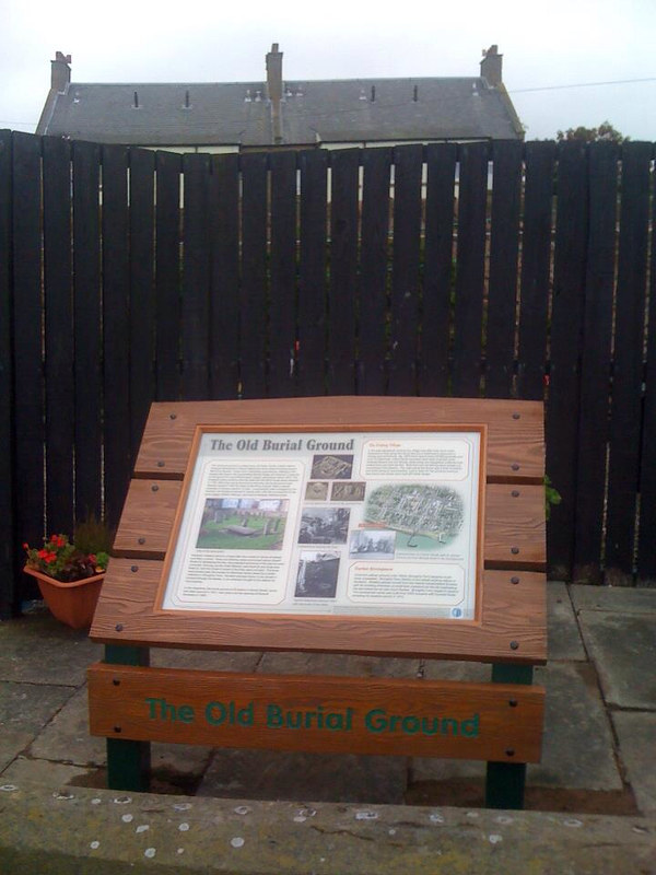
Over the last few weeks, folk walking along Fisher Street may have noticed the colourful and informative new story boards about the Fisherman's Burial Ground - see above. This will hopefully raise interest in what lies behind the fence and the handsome new gates just erected round the corner. Hidden from general view for so long, the burial ground contains some fascinating insights into the history of Broughty Ferry.
 
These small but significant improvements are the work of the Broughty Ferry Development Trust. They had identified the old burial ground as one of their first projects deserving some minor improvements to enhance access and information for potential visitors. This is the first more tangible outcome from a number of projects that the Trust has been quietly undertaking on behalf of the community.
 
Follow Broughty Ferry Development Trust on Facebook.
 

08/01/2012

Protecting the Seawall - Rapid Council Response

Coned off section of Fisher Street
above breach in the sea wall
On Thursday, I wrote to the City Engineer about a breach in the sea wall in Broughty Ferry, which I had identified after the recent storm force weather. On Saturday, I received thanks for bringing this to the the Council's attention.


I was also relieved to be told that the sea wall from Grassy Beach to Beach Crescent had been inspected on Friday and the immediately affected area had been coned off as a precautionary measure. I have also been informed that permanent repairs are to be carried out commencing on Monday 9 January 2012. Other areas of lesser remedial works to the sea wall will apparently be carried out at the same time.

In relation to the engineering report I had requested, it was reassuring for residents to know that the City Engineer had already instructed an inspection of the full Dundee coastline after the recent storms. Additionally he confirmed that consultants had already been appointed to carry out a study of the Dundee coastline and that the outcome of that study will be reported to a Council Committee.

Well done to the Council for responding promptly and comprehensively.

07/01/2012

Call for Repairs to the Sea Wall in Broughty Ferry and an Engineer's Report

On Thursday afternoon, I had a look at the stretch of the sea wall that runs alongside Douglas Terrace to the Broughty Ferry Lifeboat station. I was concerned about what I was able to observe.  After the recent spate of gale force winds, there is evidence of damage to the sea wall with sections of dislodged stonework. In some places it is also clear that storm force waves have got behind some sections of the wall potentially undermining it.

I have written to the City Engineer to request an immediate inspection of the entire length of the wall from Grassy Beach (underneath the walkway) to the Harbour with immediate repairs instructed where the wall has been undermined. I have also requested a report to go to a future meeting of the City Development Committee assessing the adequacy of the sea wall bearing in mind the recent weather patterns and the potential threat to the footways and roads that runs alongside the wall. 

The photograph I took on the beach shows an obvious breach in the sea wall beside Fisher Street in Broughty Ferry. The hole in the sea wall extends back underneath some distance. I think the full extent of this undermining and further erosion of the stonework along the wall needs to be examined as a matter of urgency.